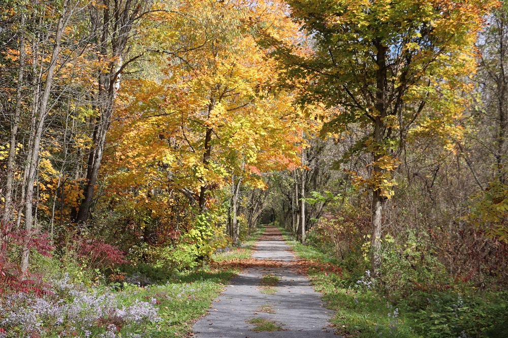
The Cataraqui Trail provides various terrain for hiking and climbing on a clearly marked trail. If you live close to the trail, use it for your daily walk or jog. Or pack a lunch and hike to one of the bench rest stops or lakes along the trail.
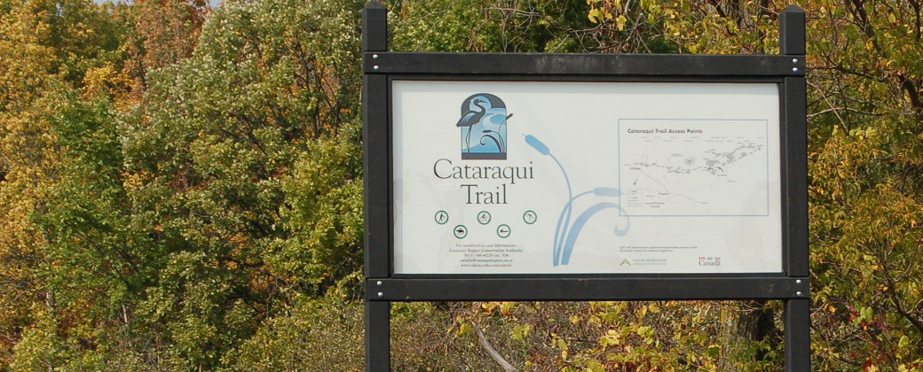
Cataraqui Trail
The Cataraqui Trail is a year-round, shared-use recreation trail. In spring, summer and fall it welcomes everyone from hikers to cyclists. In winter it is open to snowmobilers bearing a current Ontario Federation of Snowmobile Clubs trail permit. Cross-country skiers are welcome to share the trail.
Cataraqui Trail
Trail Activites
Skiing / Skijoring / Snowshoeing
When there is sufficient snow, the trail is groomed for use by snowmobiles. Cross-country skiers are welcome on the groomed trail but should be prepared to step to the side to allow snowmobiles to pass. The most scenic sections are from Perth Road (with a parking lot), heading east towards Chaffey’s Lock.
In places a layer of new gravel has been added, in others, the trail has become grassy dirt. Generally, a bike with hybrid or mountain bike tires is recommended. About 31km out of the 102km total (30%) has a “nice” surface for most cyclists. Some sections are very rough and difficult for the average cyclist. The good and the rough sections are:
Good surface:
km 0-5 Smith Falls (recently resurfaced with fine gravel – very smooth)
km 24.8-26.2 South of Portland
km 62.9-63.5 West of Norway Rd
km 66.8-68.2 West of Hogan Rd (resurfaced with stone dust – very smooth)
km 74.2-78.9 K&P trail and east to Loughborough-Portland Rd
km 84.3-102 Stone Mills Township (resurfaced with stone dust – very smooth)
km 78.9-84.3 West of Harrowsmith to Stone Mills Township (recently resurfaced)
Rough surface:
km 32-34.5 East of Hwy 15
km 54.9 Subject to flooding
km 55.5-58.8 MacGillivray to Maple Leaf
Please alert slower moving trail users of your presence, so that they can move aside and allow you to pass safely.
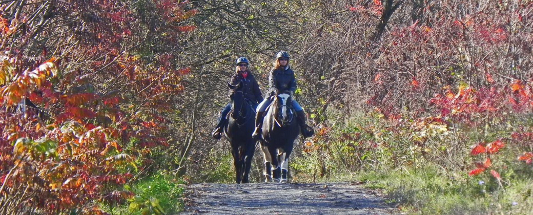
Horseback riding is permitted on the trail.
Parking for trailers (horse & snowmobile) is available at most trailheads that have been developed over the years. Some require more driving skills than others.
- Camden East
- Yarker (Snowmobile Club)
- Harrowsmith
- Perth Road Village (parking lot)
- Highway 15
- Portland
Decent roadside parking is available at most other public intersections as well as at Ferrara Drive in Smith Falls or the Fairgrounds in Lombardy. It would depend on how skittish the horse(s) is (are) relative to motorized traffic.
Due to trail limitations, such as limited turnaround space and locked gates, no wagons, carts, or other horse-drawn vehicles are permitted on the trail.
The Cataraqui Trail is a trunk snowmobile route – an important link in Ontario’s network of snowmobile trails. Snowmobilers using the Cataraqui Trail must have a valid OFSC Snowmobile Trail Permit.
The snowmobile trail on the Cataraqui Trail from Smiths Falls to McGilvray Road (km 55.4) is maintained by the Rideau Ridge Riders Snowmobile Club and the Athens and District Snowmobile Club.
The Lennox and Addington Ridge Runners Snowmobile Club ( www.laridgerunners.ca ) maintains the snowmobile trail on the Cataraqui Trail from McGilvray Road to Strathcona.
The Leeds and Grenville Snowmobile Association (ucsr.ca) maintains the snowmobile trail on the Cataraqui Trail from McGilvray Road to Smith Falls.
General Landscape
From Smiths Falls (km 0) to Chaffey’s Lock (km 42) the trail passes through flat farmland and woods overlying limestone and sandstone. From Chaffey’s Lock (km 42) to Eel Bay (km 68.5) on Sydenham Lake, the trail traverses a neck of the Canadian Shield known as the Frontenac Axis. This links the vast Shield country to the north with its smaller but most impressive southern extremity, the Adirondack region of upper New York State. The Shield country is identified closely with its dominant geological characteristics of rugged, hilly forests, plentiful lakes and swamps and numerous outcrops of attractive pink granite and grey gneiss. From Eel Bay (km 68.5) to Strathcona (km 103) the trail crosses mainly flat agricultural land known as the Napanee Plain.
Wildlife Habitat
When crossing the agricultural landscape, the trail right-of-way is generally bordered on both sides by a narrow, natural hedgerow of sun-tolerant native trees, shrubs and plants. This provides ideal habitat for a wide variety of insects, birds and small mammals. In swampy areas, the right-of-way offers a dry respite to the surrounding marshes much appreciated by egg-laying turtles who will take advantage of the gravelly banks along the edge of the trail.
In forested areas, the trail provides sunlit edges to the otherwise shaded forest floor. These edges permit the growth of sun-tolerant vegetation such as wild apple trees, berry bushes and grass, thereby enhancing the forage possibilities for numerous animal species. The observant trail user will encounter: a variety of birds including herons, ospreys and turkeys; several varieties of turtle including the snapping turtle; several species of snake including the endangered black rat snake; and numerous mammals such as mice, chipmunks, squirrels, rabbits, otters, foxes, coyotes, and deer.
Trail Conditions
The Cataraqui Trail follows the former Canadian National Railway line from Smiths Falls to Strathcona near Napanee. Therefore, the trail has no steep grades of over 5%. The only exceptions to this are at Opinicon Road (km 59.1) and Colebrook Road (km 87.8) where the railway overpasses were removed and at km 69 where the trail was detoured up the hill around some cottages.
The trail surface is usually the gravel surface of the old railbed. In many places, an additional layer of crushed stone (granular A – ¾ inch minus) has been added. In 2008 and 2009, stone dust surfacing was placed from Hogan Road (km 66.8) to Boyce Island (km 68.2) and from Yarker (km 88.8) to East Street in Newburgh (km 98.4). This work was done with the help of grants from the Ontario Federation of Snowmobile Clubs and the National Trails Coalition. A stone dust surface is more expensive but provides a smoother ride than the rest of the trail. Approximately 30% of the trail has this stone dust surface so a hybrid or mountain bike is the best choice for cycling on the trail.
The following sections represent the best trail conditions for cycling:
Km 0-5 Smith Falls
Km 24.8-26.2 South of Portland
Km 62.9-63.5 West of Norway Rd
Km 66.8-68.2 West of Hogan Rd
Km 74.2-78.9 K&P trail and east to Loughborough-Portland Rd
Km 84.3-102 Stone Mills Twp
Trail Distance Markers
Kilometer marker posts spaced at 5 km or less indicate the total distance from the Smiths Falls trailhead.
Cell phone reception is generally available on the east and west sections of the trail. However, in the rugged Canadian Shield between Chaffey’s Lock and Perth Road Village cellular service is unreliable or non-existent; plan accordingly.
Be aware that poison ivy and wild parsnip are widespread along the trail. Vegetation is regularly trimmed to reduce the chance of contact with these plants on the trail itself. Please stay on the maintained trail-surface area. If you wander off into uncut vegetation, your risk of contact with these plants increases. Learn what these plants look like (see 5 poisonous plants of Southern Ontario you should avoid).
Sign up to our Newsletter
Stay up to date on the Township's activities, events, programs and operations by subscribing to our eNewsletters.